In the final days leading up to Christmas, the weather will vary widely across the United States. From flooding risks and snow in parts of California to record warmth in the central U.S. to a series of storms that will bring a wintry mix to the Northeast, only some parts of the country are expected to see a white Christmas this year.
A record number of people are expected to travel over the year-end holidays, according to AAA's projections. Approximately 122.4 million Americans, a 2.2% increase from 2024, will venture out at least 50 miles from home from Dec. 20 through Jan. 1.
Here’s what travelers can expect for the weather this holiday week.
Flooding rain, snow are expected to impact California this week

Two powerful atmospheric rivers are expected to bring flooding rain and damaging winds to California through Christmas Day, raising travel safety concerns during the peak holiday travel season, according to meteorologists.
“Atmospheric rivers are relatively long, narrow regions in the atmosphere — like rivers in the sky — that transport most of the water vapor outside of the tropics,” the National Oceanic and Atmospheric Administration says.
The first of two atmospheric rivers in Northern California has brought an excess of 6 inches of rain over a 48-hour period in some areas, resulting in one fatality and prompting multiple water rescues in Redding, Calif., according to AccuWeather.
Early this week, Northern California is forecast to get 2-4 inches of rain across the Sacramento Valley and the San Francisco Bay Area.
A second atmospheric river is forecast to affect Southern California from Tuesday night to early Friday, with rapid urban and small-stream flooding and mudslides. About 4-8 inches of rain is expected in the Los Angeles Basin, while the Traverse Ranges could see up to 12 inches of rainfall, meteorologists say.
At least 41 million people were under flood watches as of Monday afternoon, including most of California and parts of Nevada and Arizona.
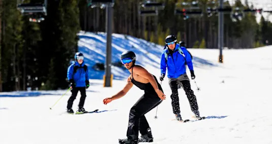
The storms are also bringing several feet of snow to the Sierra Nevada. Heavy snowfall from late Wednesday to Friday is expected to bring 1-2 feet of snow to Donner Pass in California, along Interstate 80, potentially bringing travel to a standstill. Access to mountain resorts may also be blocked.
“Ski resorts want plenty of natural snow on their slopes, especially during the industry's busy holiday season. However, so much snow may pile up that it could block roads to access the resorts located in the higher elevations,” AccuWeather reports.
Storms will bring a wintry mix to the Northeast

Two storms are targeting the Northeast, bringing a mix of rain, snow and ice through Christmas, which could potentially impact travel.
From Monday into Tuesday, snow, sleet and freezing rain coming from the Great Lakes will head into the mid-Atlantic and New England. In parts of central and south-central Pennsylvania, up to 0.10 inches of ice buildup on surfaces from freezing rain is possible, according to the latest from AccuWeather.
Across northern New York and much of New England, about 1-3 inches of snow is expected to accumulate, while the Adirondacks and Green Mountains and White Mountains are expected to see 3-6 inches of snow.
By midweek, drier and warmer air will calm things down, as temperatures are expected to rise 10-15 degrees above average.
A second storm is expected to arrive around Christmas from late Wednesday through Thursday. The Ohio Valley to the mid-Atlantic and Northeast are forecast to mostly get rain.
Right on the heels of the rain, another storm will bring more widespread wintry precipitation, possibly from the Great Lakes to the Northeast coast from Christmas night through Friday, meteorologists say.
An unseasonably warm Christmas Day for the central U.S.

About 280 million Americans in the central U.S. will experience above-average temperatures this week, as a surge of warm air in the region could result in dozens of cities having their warmest Christmas on record, according to AccuWeather. Some of those cities are: Kansas City, Mo.; Tulsa, Okla.; Wichita, Kan.; Albuquerque, N.M.; and Amarillo, Texas.
"Close to two dozen states, from parts of the Rockies to portions of the Appalachians, northward through much of the Plains and part of the Midwest, are forecast to experience temperatures that are 15-30 degrees above the historical average by Christmas Day," said AccuWeather meteorologist Alyssa Glenny. "At this level, the warmth will be comparable to late April or early May."
Travelers from the Gulf Coast to the Appalachians and Atlantic Coast should be on the lookout for potential flight delays or disruptions in road travel, as the warmth will create low clouds and fog, resulting in reduced visibility.
latest_posts
- 1
 Extraordinary Picks for Home Apparatuses: Making Life Simpler
 - 2
 Figure out How to Analyze Medical attendant Compensation Patterns Across Different Specializations
 - 3
 6 Savvy Locks for Lofts
 - 4
 Doritos and Cheetos debut 'NKD' options, without artificial colors or flavors
 - 5
 'Fertiliser costs mean I'm better off not planting'
 Figure out How to Pick a Crematorium: Key Contemplations.
 When a sperm whale gives birth, the mother gets help from her friends
 As Western heat wave ends, scientists try to make sense of its length and intensity
 Child influencers helped power a booming industry. It's time for a reckoning.
 Working out at the airport? Some fliers can already smell the sweat.
 Bismuth’s haredi draft bill won’t change enlistment, IDI expert tells 'Post'
 Sun storms are powered by a magnetic engine 16 Earths deep, study finds
 Coca-Cola Co. and bottlers to invest in South Africa operations
 Volkswagen Just Revealed a Massive Range-Extended SUV for China, and America Isn’t Getting It


